THANKS TO SHANE WASIK FOR HIS RESEARCH AND PERMISSION TO PUBLISH THIS REPORT ON HIS PROJECT.
The datum used to produce the final site map.
Over 100 dives were made on the site.
However, as always, the difficult work was interpreting the data collected and converting it to an accurate record.
The team spent many a long night interpreting sketches and measurements to construct the site plan, even on a basic level. It only takes one erroneous number to skew the whole section, but that is the joy of archaeology at 34m.
Although our site plan was still being finalised in preparation for submission to the NZAA, we had been able to identify a number of features and artifacts on the wreck before the work was completed. These included bollards and steam winches, lifeboat davits, boilers and engines, hull plating, propeller shafts, and stern propeller blade. One of the future goals of the project is to promote the site as a recreatioal dive trail where divers can follow a marked route and observe various artefacts, allowing them a greater understanding of the wreck and increased enjoyment from the dive.
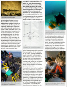
We where successful in obtaining accurate width, length and height measurements for all sections of the wreck, which are complemented by data from a multi-beam sonar survey conducted by the University of Waikato. This has allowed us to produce a highly accurate representation of the site cross-referenced to our GPS points.
Stevie Adams, a diving colleague of mine from Scotland, used the available HD video along with site measurements, sonar data, and high-resolution images to create a superb artistic rendering of the site, which is a great visual asset when describing the site to non divers or with which new divers can familiarize themselves with the wreck before they actually enter the water. We are hoping to use all the information, photographs and footage to create trail maps, signage and video.


